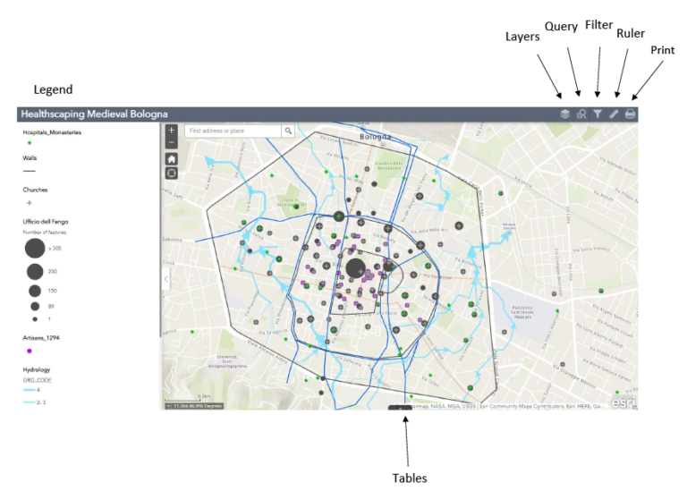
This is an active map with layers that can be turned on and off. At the top left corner there are five user functions, including two search options: query and filter. Learn how to use them and more in the video tutorial below!
Legend- Shows the different layers and symbols.
Layers- Different sets of information that can be turned on and off.
Query- Perform a search based on specific attributes.
Filter- Removes data based on specific attributes.
Ruler- Measure the distance between two points.
Print- Generates a pdf of the map.
Tables- Shows all the attribute tables for each layer