How to Use
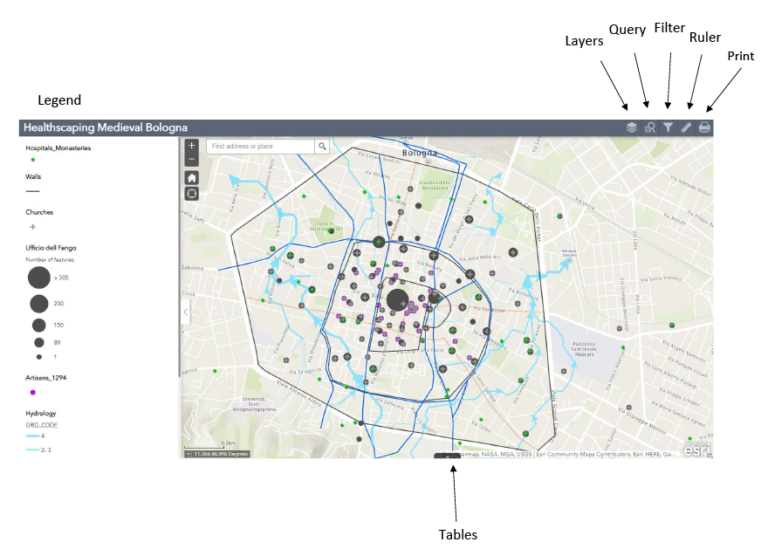
This is an active map with layers that can be turned on and off. At the top left corner there are five user functions, including two search options: query and filter. Learn how to use them and more in the video tutorial below!

Legend- Shows the different layers and symbols.
Layers- Different sets of information that can be turned on and off.
Query- Perform a search based on specific attributes.
Filter- Removes data based on specific attributes.
Ruler- Measure the distance between two points.
Print- Generates a pdf of the map.
Tables- Shows all the attribute tables for each layer